Happy Teams Connect With
Team
Connect
Maps
A comprehensive GIS Mapping based
Team Operation Management Solution.
BOOK A
LIVE DEMO
Happy Teams Connect With
Team
Connect
Maps
A comprehensive GIS Mapping based
Team Operation Management Solution.

BOOK A
LIVE DEMO
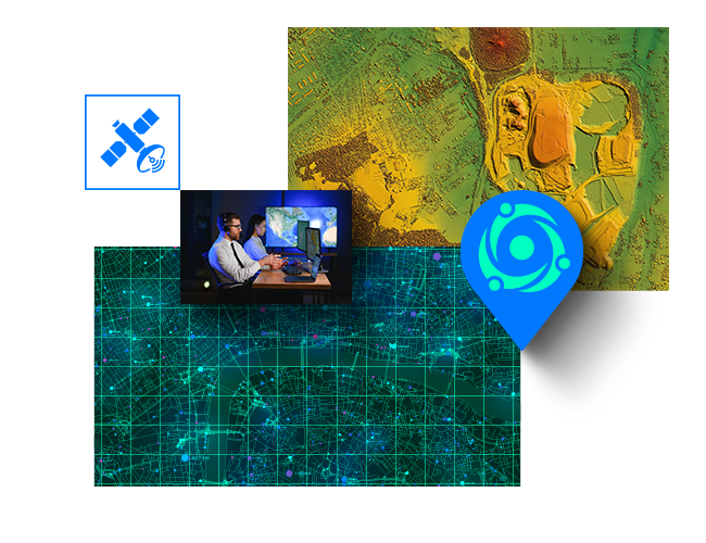
Why Choose
Team Connect Maps?
System User
Roles & rights
Discover top-notch GIS development solutions customized for your specific requirements with us. Our talented development team can construct custom GIS apps for any business that uses spatial analysis, including urban planning, environmental management, and other fields.
Team
Admins
Manage user roles and
permissions.
Configure system settings
(e.g., geofences, maps, data layers).
Monitor and manage incidents
in real-time.
Access all reports,
files and analytics.
Control access to system integrations
(ArcGIS, camera feeds, etc.).
View and export data for
audits and compliance.
Manage Reports &
Analysis.
Operation
Managers
Oversee all aspects of incident management.
Create and update
incident action plans (IAP).
Assign tasks to teams and
monitor their progress.
Coordinate with teams using
the chat and communication tools.
Set up and manage
the Incident Command Post (ICP).
Access map data and
incident locations in real-time.
Create and assign
custom reports.
Approve emergency
actions or evacuations.
Field
Staff
Receive and manage task
assignments from
the Incident Commander.
Track team activities
and update task statuses.
Report back on
incident progress and
resource needs.
Communicate with team
members and other leaders
through the chat system.
Use map and geofence
tools to track team and
incident locations.
Add reports,
placemarks and updates
to incident files.
COP | Dashboard | Reports & Analysis
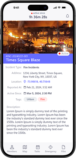
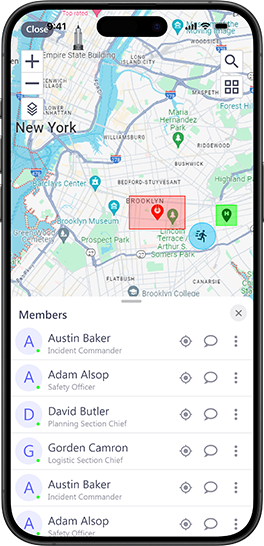

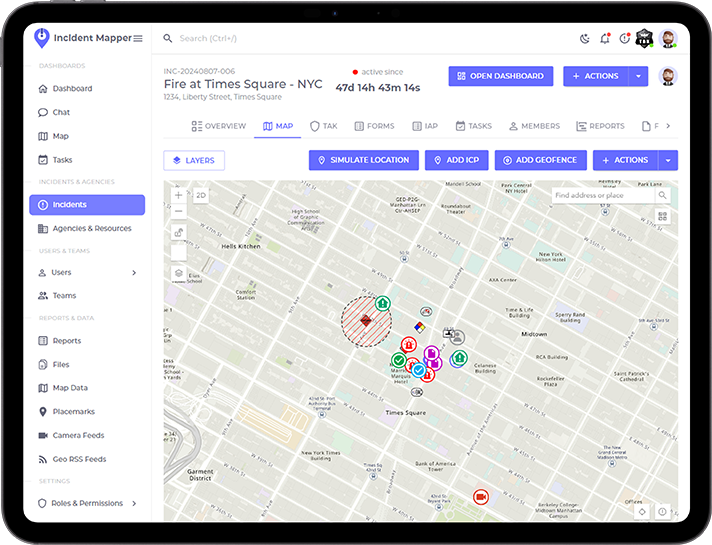
COP | Dashboard
Reports & Analysis


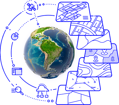
GIS Specific Details
Discover top-notch GIS development solutions customized for your specific requirements with us. Our talented development team can construct custom GIS apps for any business that uses spatial analysis, including urban planning, environmental management, and other fields.
Forms for
data collection
OSM Vector Tiles with Stylesheet
GPKG GeoPackage Vector Features, Vector Tiles and Raster Tiles
MBTILES vector tiles, raster tiles and elevation/terrain tiles
3DTILES archive 3TZ
GLB 3D Model format

Marker Symbol &
Other Supports
OSM Vector Tiles with Stylesheet
GPKG GeoPackage Vector Features,
Vector Tiles and Raster Tiles
MBTILES vector tiles, raster tiles and
elevation/terrain tiles
3DTILES archive 3TZ
GLB 3D Model format

ESRI ArcGIS, Mapbox,
QGIS, Web view
OSM Vector Tiles with Stylesheet
GPKG GeoPackage Vector Features,
Vector Tiles and Raster Tiles
MBTILES vector tiles, raster tiles and
elevation/terrain tiles
3DTILES archive 3TZ
GLB 3D Model format

Real-time Data & Video Modules with TAK
OSM Vector Tiles with Stylesheet
GPKG GeoPackage Vector Features,
Vector Tiles and Raster Tiles
MBTILES vector tiles, raster tiles and
elevation/terrain tiles
3DTILES archive 3TZ
GLB 3D Model format

Forms for
data collection
OSM Vector Tiles with Stylesheet
GPKG GeoPackage Vector Features,
Vector Tiles and Raster Tiles
MBTILES vector tiles, raster tiles and
elevation/terrain tiles
3DTILES archive 3TZ
GLB 3D Model format
Marker Symbol &
Other Supports
OSM Vector Tiles with Stylesheet
GPKG GeoPackage Vector Features,
Vector Tiles and Raster Tiles
MBTILES vector tiles, raster tiles and
elevation/terrain tiles
3DTILES archive 3TZ
GLB 3D Model format


ESRI ArcGIS, Mapbox,
QGIS, Web view
OSM Vector Tiles with Stylesheet
GPKG GeoPackage Vector Features,
Vector Tiles and Raster Tiles
MBTILES vector tiles, raster tiles and
elevation/terrain tiles
3DTILES archive 3TZ
GLB 3D Model format
Real-time Data &
Video Modules
with TAK
OSM Vector Tiles with Stylesheet
GPKG GeoPackage Vector Features,
Vector Tiles and Raster Tiles
MBTILES vector tiles, raster tiles and
elevation/terrain tiles
3DTILES archive 3TZ
GLB 3D Model format

Ideal For
Organizations &
Bussinesses like
Public Safety Organizations
Your content goes here. Edit or remove this text inline or in the module Content settings.
Public Safety Organizations
Your content goes here. Edit or remove this text inline or in the module Content settings.
Public Safety Organizations
Your content goes here. Edit or remove this text inline or in the module Content settings.
Public Safety Organizations
Your content goes here. Edit or remove this text inline or in the module Content settings.
Public Safety Organizations
Your content goes here. Edit or remove this text inline or in the module Content settings.
Public Safety Organizations
Your content goes here. Edit or remove this text inline or in the module Content settings.
Public Safety Organizations
Your content goes here. Edit or remove this text inline or in the module Content settings.
Public Safety Organizations
Your content goes here. Edit or remove this text inline or in the module Content settings.
Public Safety Organizations
Your content goes here. Edit or remove this text inline or in the module Content settings.
Public Safety Organizations
Your content goes here. Edit or remove this text inline or in the module Content settings.
Public Safety Organizations
Your content goes here. Edit or remove this text inline or in the module Content settings.
Public Safety Organizations
Your content goes here. Edit or remove this text inline or in the module Content settings.
Public Safety Organizations
Your content goes here. Edit or remove this text inline or in the module Content settings.
Public Safety Organizations
Your content goes here. Edit or remove this text inline or in the module Content settings.
Public Safety Organizations
Your content goes here. Edit or remove this text inline or in the module Content settings.
Public Safety Organizations
Your content goes here. Edit or remove this text inline or in the module Content settings.
Utility operation management
how it works
Discover top-notch GIS development solutions customized for your specific requirements with us. Our talented development team can construct custom GIS apps for any business that uses spatial analysis, including urban planning, environmental management, and other fields.
Potential
Integrations &
Platform
Support

EAM
Electronic Asset Management Systems (Work Management) Integration
EAM
Customer/Client Resource Management
EAM
Enterprise Resource Planning
EAM
Capital Improvement Systems, Other Back-End Systems and API’s
Potential
Integrations &
Platform
Support

EAM
Electronic Asset Management Systems (Work Management) Integration
EAM
Electronic Asset Management Systems (Work Management) Integration
EAM
Electronic Asset Management Systems (Work Management) Integration
EAM
Electronic Asset Management Systems (Work Management) Integration
Read More About
GIS Team Collaboration
EAM – Electronic Asset Management Systems6
Welcome to WordPress. This is your first post....
EAM – Electronic Asset Management Systems5
Welcome to WordPress. This is your first post....
EAM – Electronic Asset Management Systems4
Welcome to WordPress. This is your first post....
For
GIS Based
Team
Collaboration &
Awareness
Solutions
For GIS Based
Team Collaboration &
Awareness Solutions
